Top mapmakers are busily updating their
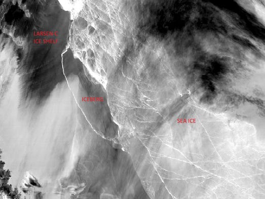
charts after a massive iceberg sheared off Antarctica, fundamentally
changing the landscape of the peninsula — likely forever.
The 1 trillion ton iceberg that broke off the Larsen C ice shelf is the size of Delaware and one of the largest ever recorded.
National
Geographic said its map database will be immediately updated to
illustrate the new configuration. Meanwhile, changes to its traditional
print map and atlas products will occur as part of a regular cycle of
updates, said Alex Tait, a National Geographic geographer.
Alexis Sadoti, spokesperson at Rand McNally, says the
mapmaking company follows a similar procedure and will illustrate the
shelf's new look on its close-up or detailed Antarctica maps as part of
its schedule of regular book updates.
However, most of Rand McNally's world maps show the coastline of Antarctica and not the ice shelf itself, Sadoti said.
Scientists
with Project MIDAS, which monitors the ice shelf, said it's likely the
remains of Larsen C are now too fragile to grow back to its former size.

Comments
Post a Comment